

US Casualties in Iraq War
The Iraq War or the Second Gulf War has been in the United States geopolitical forefront well prior to its occupation of Iraq on March 20, 2003. Due to September 11, 2001, United States national security and geopolitical policies morphed to suppress the rise in global terrorism. United States and Coalition forces occupation of Iraq has been prolonged due to a rise in insurgency. Insurgents have caused the most havoc and deaths to U.S. soldiers in Iraq via improvised explosive devices (IED). Whether the United States and Coalition forces will leave Iraq with positive affects/outcomes is yet to be determined, only time will tell. Our final project for this crash course in the Introductory to Geographic Information Systems is one, to create a reference map illustrating Iraqi cities, provinces, and major rivers; and two, to create a thematic map of Iraq to display the spatial distribution of U.S. Casualties throughout Iraqi provinces.
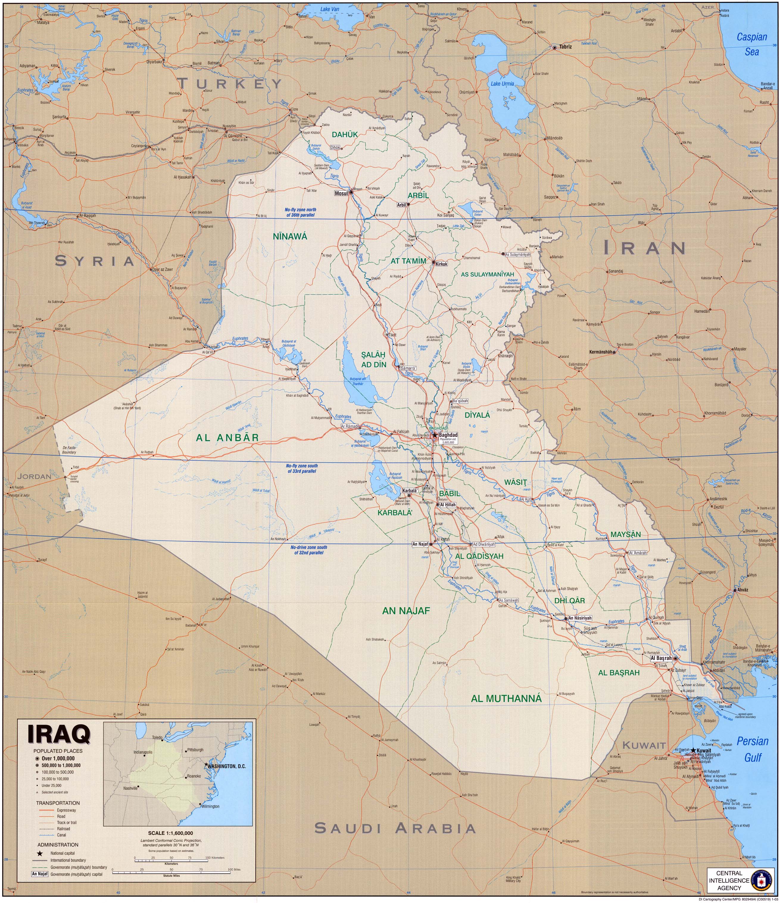
The first map is a reference map of Iraq which I created by geo-referencing and digitizing the below mentioned cited map. Three layers were created: provinces, rivers and cities.
Data source cited for the reference map of Iraq titled, “Political Map of Iraq:”
Central Intelligence Agency (CIA) 2003. Iraq [map/j-peg]
Langley, Virginia. Central Intelligence Agency (CIA). University of Texas Map Library [distributor] http://www.lib.utexas.edu/maps/middle_east_and_asia/iraq_cia_2003.jpg
The second map is a thematic map of Iraq displaying U.S. casualties per province. A yellow/red color gradient was used to show five different numeric ranges of deaths within all 18 Iraqi provinces. This allows the reader to be visually aware of the spatial distribution of deaths in Iraq. The reader can refer to the legend to find the range of deaths in each respective province. The province of Baghdad boasts the highest number of U.S. casualties to date, 1,305 deaths since March 20, 2003. Al Anbar province has the second highest death count, 1,302. The number of deaths for the third highest province, Salah Ad Din, is significantly less with 396 deaths to date. These three provinces share a common characteristic; they are located in the center of Iraq in highly populated areas. The next nine Iraqi provinces with a significant amount of deaths also follow a trend. They all lie within or border the Tigris and Euphrates Rivers. The majority of Iraqi cities are located along these two major rivers. The last six provinces fall under the category of having the least amount deaths, zero to thirteen, or yellow category. These provinces are adjacent to the border of Iraq and are scarcely populated.
Another common trend I noticed in researching U.S. Casualty Count in Iraq, which is not mentioned in thematic map, is the significant decrease in deaths per year in each province since the U.S. troop surge. There is an average of 75% less casualties in each province year to date in 2008 from 2007. There is still 25% of the year left in 2008 but it is so significant, I feel it is imperative to note! Two GIS maps can be made to show the difference in number of deaths per year and the percent change. This can be useful for the military as they have specific coordinate information regarding the casualties and can concentrate thier efforts in specific regions accordingly. Or it can be used for simple propraganda.
Data sources cited for the thematic map of Iraq, titled, “US Casualties in Iraq:”
Central Intelligence Agency (CIA) 2003. Iraq [map/j-peg]
Langley, Virginia. Central Intelligence Agency (CIA). University of Texas Map Library [distributor] http://www.lib.utexas.edu/maps/middle_east_and_asia/iraq_cia_2003.jpg
United States Department of Defense (DOD) 2008 / USCENTCOM 2008 [publishers]
Arlington, Virginia. U.S. Department of Defense / Tampa, Florida. CENTCOM
icasualties.org 2008 [distributer] Coalition Deaths by Province (US only) [table/online]
Extracted, September 15, 2008
http://icasualties.org/oif/Province.aspx


